SL-TF 299 El Centeno
Technical information
- Start: Las Lagunetas (TF-24, km.16)
- Finish: At the square by the church of San José (Barranco Hondo)
- Approval status: Approved
- Degree of difficulty: Intermediate
- Type of trail: Linear
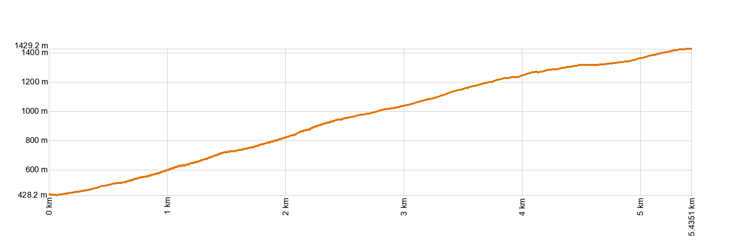
- Distance: 5.7 km (12.89 ft)
- Duration: 2 hours 30 mins.
- Highest altitude: 1,414 m (12.89 ft)
- Lowest altitude: 407 m (12.89 ft)
- Elevation gain: 56.8 m (12.89 ft)
- Elevation loss: 1,043 m (12.89 ft)
- Links to other trails:
- SL-TF 301 Las Barreras Circular
- Protected Nature Areas:
- Authorisation required: No
Trail description
The Lomo El Centeno trail awaits you with stunning views over the Valley of Güímar, the city of La Laguna and the slopes of Anaga Rural Park. This traditional walk is an opportunity to discover some of the most significant species of local and endemic flora and fauna that typically inhabit the mountain tops. Moreover, hikers will be walking through the Protected Landscape of Las Lagunetas. The forest still shows signs of how it was once used to obtain resin from the pine trees to provide boats with a waterproof coating.
Hypsometry
For your own safety, don't forget to check the condition of the trail.
The competent authority will be responsible for informing you if the trail is not recommendable in the wake of adverse weather conditions, as well as if the trail or part of it is closed, etc.
- Competent authority: Candelaria Town Council
- About the competent authority: SL-TF 299 Lomo Centeno
![]() In case of an emergency, call 112.
In case of an emergency, call 112.
Download FRESS 112, available for iOS and Android
Weather Today


