PR-TF 10 Cruz del Carmen - Punta del Hidalgo
Technical data
- Starting point: Cruz del Carmen
- Finish point: Punta del Hidalgo
- Certification status: Approved
- Degree of difficulty: Medium
- Type of route: Linear
- Distance: 10.4 km
- Duration: 4 h
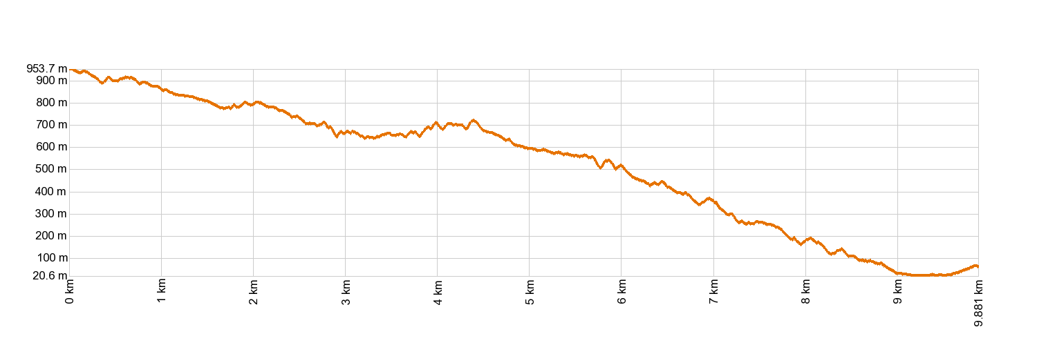
- Maximum height: 949 m
- Minimum height: 10 m
- Cumulative difference in altitude of ascent: 420.64 m
- Cumulative difference in altitude of descent: 1,300.38 m
- Connections with other trails:
- Protected Natural Areas:
- Authorisation required: No
Description of the route
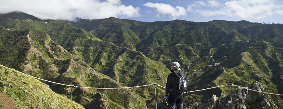
The route starts to the right of the restaurant "Cruz del Carmen" on the path that descends through Monteverde, crossing several stretches of road until it reaches the village of Las Carboneras. Once here, it continues to Chinamada and finally heads towards Punta del Hidalgo along a path carved into the rock. From this stretch, you can enjoy rugged landscapes and imposing cliffs battered by the Atlantic Ocean.
Altimetry
For your safety, don't forget to check the state of the trail.
The managing body is in charge of indicating if trails should not be used following adverse weather conditions, if they are closed or have closed stretches, etc...
- Managing body: Island Council of Tenerife
- Information from the managing body: PR-TF 10 Cruz del Carmen - Punta del Hidalgo.
In case of emergency, call 112.
Weather Today
Maximum: 26º
Minimum: 17º
San Cristóbal de La Laguna. It will be good weather on Friday morning. In the afternoon, sunny skies. At night mist is expected. Temperatures will remain unchanged.