17. Igueque
Technical information
- Start: Yegua Blanca
- Finish: La Crucita
- Approval status: Not officially approved
- Degree of difficulty: Low
- Type of trail: Linear
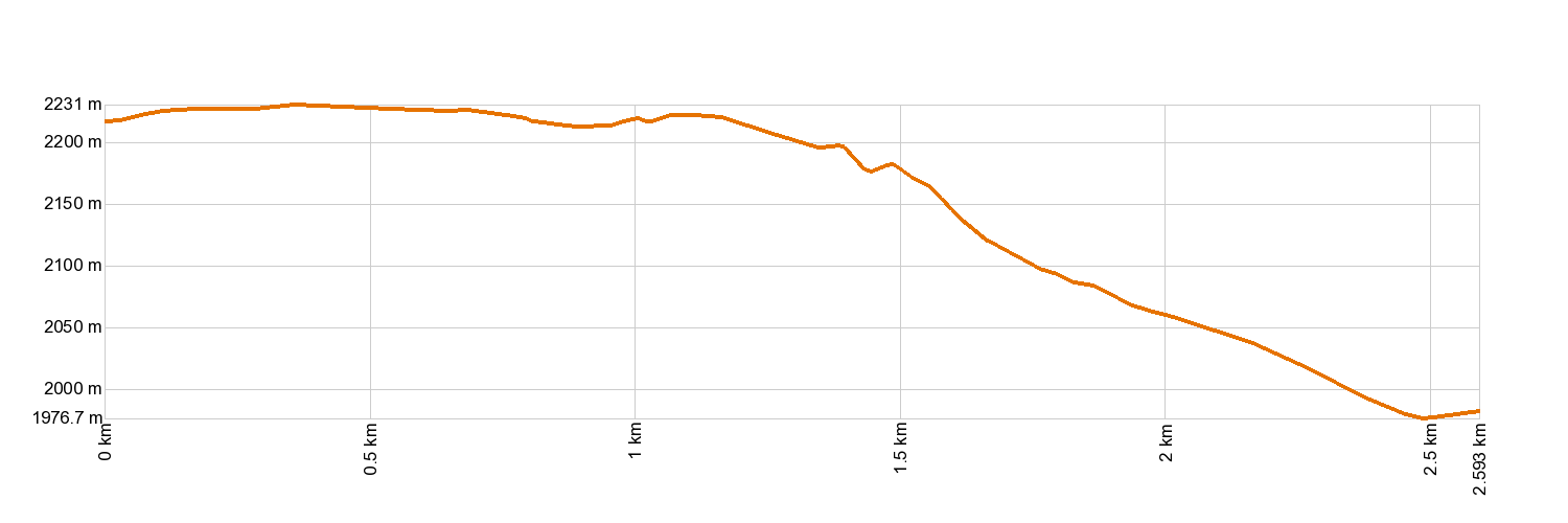
- Distance: 2.4 km (12.89 ft)
- Duration: 1 hour 20 mins.
- Highest altitude: 2,240 m (12.89 ft)
- Lowest altitude: 1,976 m (12.89 ft)
- Elevation gain: 89.8 m (12.89 ft)
- Elevation loss: 316 m (12.89 ft)
- Links to other trails:
- Protected Nature Areas:
- Authorisation required: No
Trail description
This trail gives hikers the chance to observe the contrast between the south of the Island, dominated by the Valley of Güímar, and the north face, with the spectacular Valley of La Orotava, which is often covered by a sea of fluffy clouds. The trail starts by skirting around the mountain of Igueque (2,273 m - 7,457 ft) and continues towards the mountain of La Negrita (2,245 m - 7,365 ft). Along the way, there are huge volcanic bombs nestled amidst the mountain bushes. Pine trees also adorn the scenery, especially towards the end of the trail, in La Crucita, where you will come to one of the busiest routes linking the two valleys: the pilgrimage route to visit the Virgin of La Candelaria.
Hypsometry
For your own safety, don't forget to check the condition of the trail.
The competent authority will be responsible for informing you if the trail is not recommendable in the wake of adverse weather conditions, as well as if the trail or part of it is closed, etc.
- Competent authority: Teide National Park
- About the competent authority: 17. Igueque
![]() In case of an emergency, call 112.
In case of an emergency, call 112.
Download FRESS 112, available for iOS and Android