PR-TF 83.1 Las Vegas - Los Escurriales
Technical information
- Start: Las Vegas
- Finish: Madre del Agua Track
- Approval status: In progress
- Degree of difficulty: High
- Type of trail: Linear
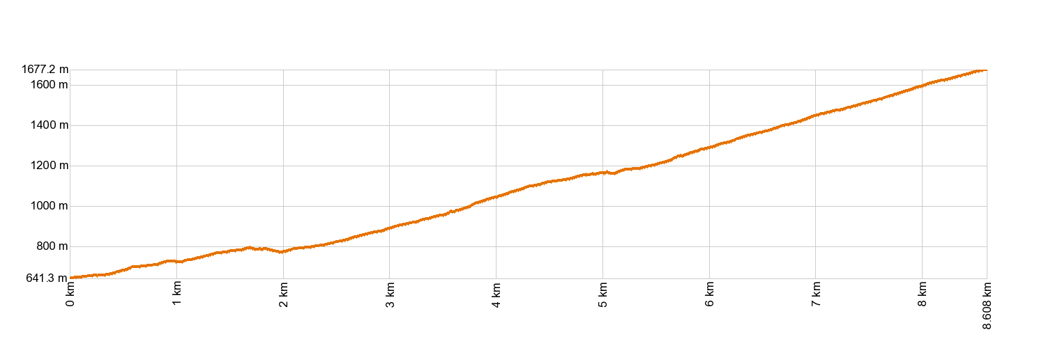
- Distance: 8.53 km (12.89 ft)
- Duration: 5 hours
- Highest altitude: 1,670 m (12.89 ft)
- Lowest altitude: 642 m (12.89 ft)
- Elevation gain: 1,102.52 m (12.89 ft)
- Elevation loss: 70.34 m (12.89 ft)
- Links to other trails:
- Protected Nature Areas:
- Authorisation required: No
- Competent authority: Tenerife Council
- About the competent authority: PR-TF 83.1 Las Vegas - Los Escurriales
Trail description
The trail starts in the hamlet of Las Vegas (in the municipality of Granadilla de Abona) and journeys through farmland scenery before gradually leading you into the pine forest. The path carries on upwards, running alongside a tongue of dry lava up to the foot of Risco del Muerto. You will then venture into the area of El Sombrío and on to Era de La Abejera along the Los Cardos path. After that, you will soon come to the old Chasna pathway and the house of Casa de La Florida. Leaving the house behind you, you will reach the Madre del Agua track where it joins the PR-TF 83 Altos de Granadilla trail.
Hypsometry
For your own safety, don't forget to check the condition of the trail.
The competent authority will be responsible for informing you if the trail is not recommendable in the wake of adverse weather conditions, as well as if the trail or part of it is closed, etc.
![]() In case of an emergency, call 112.
In case of an emergency, call 112.
Download FRESS 112, available for iOS and Android
Weather Today


