PR-TF 65 Santiago del Teide - Puerto de Santiago
Technical information
- Start: Santiago del Teide
- Finish: Puerto de Santiago
- Approval status: Approved
- Degree of difficulty: Intermediate
- Type of trail: Linear
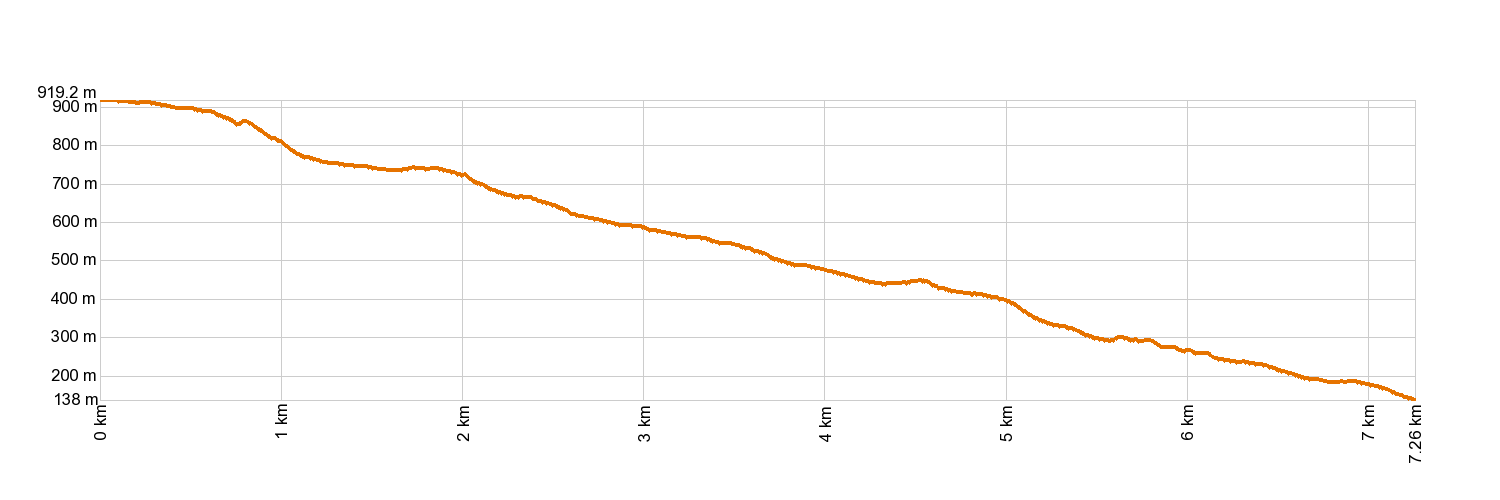
- Distance: 7.3 km (12.89 ft)
- Duration: 3 hours
- Highest altitude: 919 m (12.89 ft)
- Lowest altitude: 147 m (12.89 ft)
- Elevation gain: 42.74 m (12.89 ft)
- Elevation loss: 817.50 m (12.89 ft)
- Protected Nature Areas:
- Authorisation required: No
- Competent authority: Tenerife Council
- About the competent authority: PR-TF 65 Santiago del Teide - Puerto de Santiago
Trail description
The trail starts by the Santiago del Teide petrol station, along a broad pathway surrounded by unused farm plots. When you reach the first fork, veer left to carry on downwards until you come to an area near a gulley. You will eventually come to Tamaimo and walk on along the bottom of the ravine. There is a short stretch of cement track and then the first clusters of houses appear, followed by country estates and greenhouses. Take the stone steps down and stick to the track, then take the pathway to the left onto the paved road. Your journey ends about 500 yards ahead.
Hypsometry
For your own safety, don't forget to check the condition of the trail.
The competent authority will be responsible for informing you if the trail is not recommendable in the wake of adverse weather conditions, as well as if the trail or part of it is closed, etc.
In case of an emergency, call 112.
Weather Today


