PR-TF 2 Taborno - Pico del Inglés - Valleseco
Technical information
- Start: Taborno
- Finish: Valleseco
- Approval status: In progress
- Degree of difficulty: Intermediate
- Type of trail: Linear
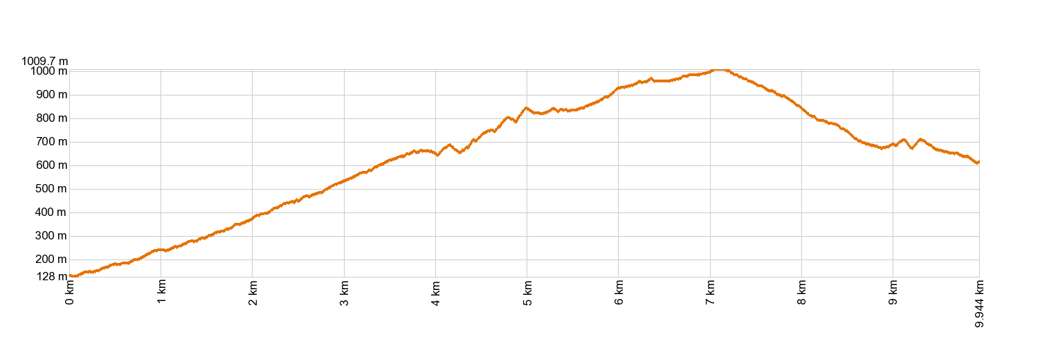
- Distance: 10 km (12.89 ft)
- Duration: 4 hours 30 mins.
- Highest altitude: 1,006 m (12.89 ft)
- Lowest altitude: 110 m (12.89 ft)
- Elevation gain: 630.58 m (12.89 ft)
- Elevation loss: 1,152.87 m (12.89 ft)
- Protected Nature Areas:
- Authorisation required: No
- Competent authority: Tenerife Council
- About the competent authority: PR-TF 2 Taborno - Pico del Inglés - Valleseco
Trail description
The trail starts in Plaza de Taborno and climbs up along the path opposite the uphill bus stop. When you get to the road, follow it for a bit. After the intersection to turn down to Las Carboneras and Taborno, cross the road and walk up some steps carved into the stone. The trail will take you to the road that goes to Pico del Inglés and down to Valleseco, past La Casa de los Berros and Las Casas de la Fortaleza.
Hypsometry
For your own safety, don't forget to check the condition of the trail.
The competent authority will be responsible for informing you if the trail is not recommendable in the wake of adverse weather conditions, as well as if the trail or part of it is closed, etc.
![]() In case of an emergency, call 112.
In case of an emergency, call 112.
Download FRESS 112, available for iOS and Android


