30. Los Valles
Technical information
- Start: The mines of San José
- Finish: Risco Verde - Cañada de Las Pilas
- Approval status: Not officially approved
- Degree of difficulty: Low
- Type of trail: Linear
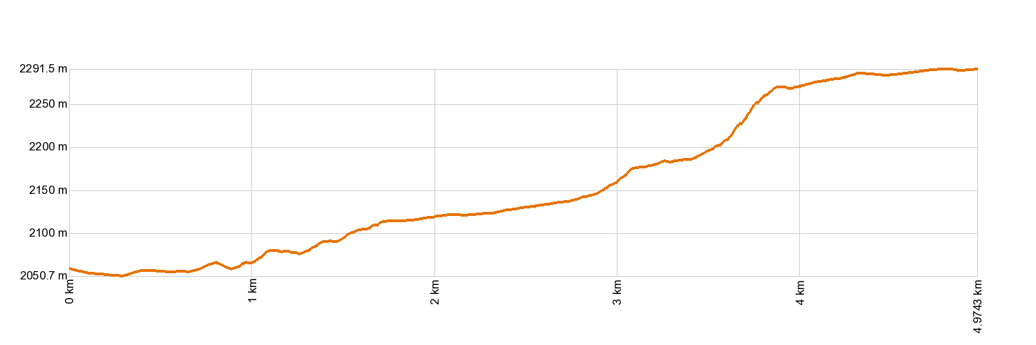
- Distance: 5.0 km (12.89 ft)
- Duration: 1 hour 45 mins.
- Highest altitude: 2,297 m (12.89 ft)
- Lowest altitude: 2,056 m (12.89 ft)
- Elevation gain: 66 m (12.89 ft)
- Elevation loss: 299 m (12.89 ft)
- Links to other trails:
- Protected Nature Areas:
- Authorisation required: No
Trail description
This easy trail takes you down from the car park area of the Mines of San José, in the middle of the National Park, all the way to Siete Cañadas Trail 4, at the foot of Risco Verde in La Cañada de las Pilas. The first stretch crosses an area which, for years, was used for extracting pumice stones, before descending through Los Valles (The Valleys) until it reaches La Cañada de Las Pilas, at the foot of the walls of La Caldera de Las Cañadas. Along the way, you will see many of the most typical plants that live in Canarian high mountain habitats, as well as some traces of how the area was used before being declared a National Park, such as chopping down broom bushes for firewood.
Hypsometry
For your own safety, don't forget to check the condition of the trail.
The competent authority will be responsible for informing you if the trail is not recommendable in the wake of adverse weather conditions, as well as if the trail or part of it is closed, etc.
- Competent authority: Teide National Park
- About the competent authority: 30. Los Valles
![]() In case of an emergency, call 112.
In case of an emergency, call 112.
Download FRESS 112, available for iOS and Android